
SLOPE SOARING SITES OF SOUTHERN ENGLAND
SLOPES N-Z
Here's information on radio control slope soaring sites (model glider flying slopes). This page lists slopes beginning with N to Z. Download the pdf from the Home page if you want this information in a prettier format with more photographs.
____________________________________________________________________
NEWHAVEN CLIFFS, EAST SUSSEX - Wind: S
Where’s that then?
On the south coast, halfway between Brighton and Eastbourne.
So what’s it like?
Newhaven is a good spot for cliff soaring. The cliffs are about 50 metres high and the best part of a mile wide. The lift is smooth and strong when the wind is from the south, and the cliffs can also usually be used when the wind is from the southwest or southeast. If you’re afraid of heights or of losing your model out to sea, this might not be the place for you. But in reality cliff soaring is more a psychological problem than an actual hazard, since it’s easy to soar over the land and avoid going much out to sea. Just make sure your battery is charged and your plane is in good shape.
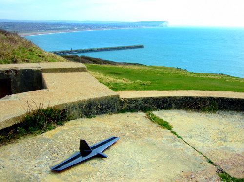
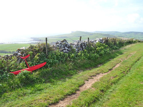
The WWII gun bases make good wind breaks
Perhaps the worst aspect of these cliffs is the lack of large landing areas. It’s all a bit narrow and backed by brambles. It isn’t terrible, but it would be a challenge to land a 4-metre scale glider here. Head west for better landing spots.
Marks out of 10?
This is a 5 ... unless you loath the challenges of cliff soaring, in which case for you it’s a 2!
Seaford Head with Beachy Head on the horizon
How do you get there then?
Drive down the A26 into Newhaven. Cross the River Oase and in the centre of town follow the brown signs to Newhaven Fort. Turn right up the fort access road and park in the fort carpark. Lug your plane up to the cliffs and throw it. There are soarable cliffs westwards almost to Brighton.
Visible to the east are more cliffs at Seaford. These are also very soarable but involve quite a long walk from the Seaford Head Local Nature Reserve carpark.
Newhaven Cliffs Map
Seaford Head Map
____________________________________________________________________________
ST AGNES HEAD AND THE SOUTH WEST - Winds: N, NW, W, SW
Where’s that then?
St Agnes Head is on the north coast of Cornwall, between Newquay and St Ives.
So what’s it like?
So much of the Cornwall coastline is soarable that it is almost pointless trying to list individual sites. However, a site that stands out as being the best in Cornwall - and one of the best in the country - is St Agnes Head.
St Agnes is a great site because it has amazingly good lift, it works in a wide variety of wind directions, and it has a huge landing area. On the other hand, there isn't much else at St Agnes Head! It could be described as a rather featureless, deserted area. But that would be missing the point: the magic is in the air.
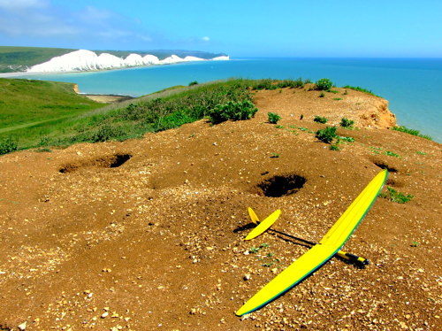
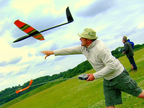
Summer evening flying at the coastguard slope
Just what makes the lift at St Agnes so good? For one thing, the cliffs are incredibly high, so the lift is big. Secondly, the air is uncannily smooth after having passed over a thousand miles of ocean. Thirdly, the top of the cliffs is rounded, with no sharp lip, so there is none of the turbulence that occurs at other high cliffs such as Beachy Head. To top it all off, the landing area is vast, flat and free of turbulence. The overall effect is to make the flying exciting yet stress-free.
Despite these advantages, St Agnes Head is often not crowded, since there are no major population centres nearby. Sometimes there are no flyers, or perhaps one or two. At other times there can be a dozen or more if a local flying club decides to organise a visit. During the summer holiday period walkers are common on the coastal path. Flyers must not fly too close to walkers - which sounds obvious but requires extra care because the path is partly out of sight.
Photographs can make St Agnes look challenging, but in reality you will be launching, flying and landing on the flat, and won't even be able to see the dramatic cliffs since they fall off gradually out of sight.
There are three carparks near three main soaring areas. The first carpark you come to is known locally as The Hump (due to the presence of a low hillock). The flying area is on the far side of the hump and faces mainly NNW. It flies best in north to northwest winds. A fraction east of north is also flyable.
A few hundred yards further along is a coast guard hut followed by a second carpark. This spot (referred to as Coastguard) faces WNW to west, and works in west to northwest winds.
Several hundred yards further along is a third carpark (Tubby's Head), which works in west to southwest winds. It is the only spot on the north coast to work in winds that are almost southerly.
Between the three of them, these spots cover 180 degrees of wind direction (from NNE to SSW) - not many sites can claim that.
The regular flyers are very welcoming and can be contacted via the 'Proper Cornish Slopers' thread of the RCMF online forum (rcmf.co.uk) or via their website, westcornwallslopers.co.uk.
The 'grass' at St Agnes makes landing easy, because it is actually low, springy broom. This cushions bad landings, but it can be prickly underfoot, so it is wise to wear shoes rather than sandals. St Agnes is probably not the place to bring small children, since they could fall down the cliffs, and besides, there isn't much for them to do on the flat. However for partners there are cliffside walks and bird watching opportunities.
Sun, sea and soaring
St Agnes Head is National Trust land. About a mile east of St Agnes - still on the same National Trust land - is a slope that faces northeast, Newdowns Head. Visiting Newdowns involves a considerable hike, since there is virtually no parking anywhere nearby. Then, when you get there, you will need the confidence to land on a very small, bushy landing area. It is possible with foamies or with mouldies with crow brakes.
Cliffs extend from St Agnes Head for many miles along the north Cornwall coast. Many of these areas are perfectly flyable but are seldom flown. The main ones that are recognised soaring sites are shown on the Slopehunter Google Map. This map lists around 200 slope soaring sites in southern England, more than double the number detailed on this website.
Marks out of 10?
St Agnes is an easy 8 - heck, maybe even a hallowed 9 - but St Agnes might not be to your taste if you prefer scratching around in weak lift, negotiating challenging turbulence, or landing in tight spots.
How do you get there then?
Drive into St Agnes. Follow your nose out of town for a couple of miles up to the headland. It is simple enough to get there, but the headland can be difficult to spot over the stone walls. Basically you're aiming to head west on Beacon Drive and then turn right into a small unnamed road past a National Trust sign. This road leads to the three carparks around the coast guard hut.
Newdowns Head is a mile closer to St Agnes. The best way to get there is to walk along the coastal path from the main St Agnes site. Alternatively, it can be accessed from a dead-end road diverting right off Beacon Drive. There is a sign saying Doble Foods. There is nowhere to park, except on weekends when the food factory is closed. Then it may be possible to fit a small car or two near there. A walking path begins near the end of the road and takes you a quarter of a mile to the flying area.
About three miles north of St Agnes is Cligga Head, which works well in northwest wind. It is almost as good as St Agnes but is not often used, since flyers in the area usually go to St Agnes. Further north, the cliffs at Tintagel work well in west wind. Southwards, Godrevy Head has two sides to it that work well in west and east winds.
The various coastal sites in Cornwall are often quite remote - do not expect a big sign, a carpark and a burger van! For instance Lizard Point on the south coast offers wonderful flying, but you have to find your way down narrow winding roads, park your car in a tiny hamlet of a few houses, and then walk a quarter of a mile to the coast. It's all part of the adventure!
The south coast of Cornwall has various other flying sites such as Cudden Point, Rinsey Head, Dodman Point and Whitsand Bay. The flying spots continue into Devon and Dorset with sites such as Kimmeridge Down, and onwards to the east, to the wonderful slopes on the Isle of White.
There are too many southwest soaring spots to go into detail, but they can be seen on the Slopehunter Google Map.
____________________________________________________________________________
THURNHAM CASTLE HILL, KENT - Wind: SW
Where’s that then?
Thurnham Castle Hill overlooks the village of Thurnham in Kent. The slope is sometimes referred to as Detling by slope soarers.
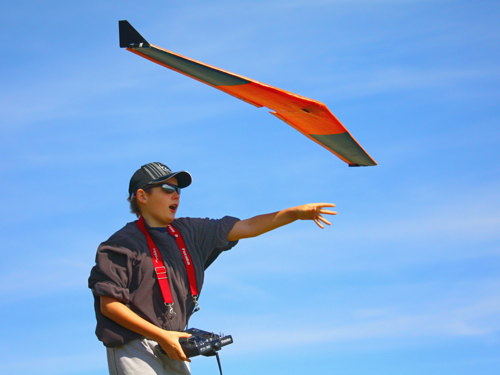
Sometimes the lift is not as good as at higher hills, but it seems to be plenty for efficient moulded soarers (paulw photo)
So what’s it like?
Thurnham Castle Hill is a very kind slope with plenty of room for stress-free landings. The slope is of medium steepness and is about 70 metres high. It doesn't produce quite as much lift as some of the bigger hills on the South Downs, but nevertheless the lift can be pretty good - which is why Thurnham Castle Hill is such a popular spot for Kent flyers.
Thurnham works well in WSW to SSW winds - and possibly west wind but not really south wind - up to about 20mph. In stronger winds it gets blown out and the lift actually reduces. The very best conditions often occur on sunny evenings with the wind at around 8-16mph and with evening thermals augmenting the lift. In low winds paragliders take off from the lower section of the slope and great care needs to be taken to avoid them.
The landing zone is excellent: large and flat, free of turbulence, and covered in nice soft grass. In fact it must be one of the nicest landing areas anywhere. The hill is public access land owned by the local council. Behind the landing area is a country park (where the carpark is) with a sign advising visitors "It is great fun to watch the model aeroplanes while enjoying a picnic"!
Just to the west of the main Thurnham slope can be seen a knoll that faces southwest around to southeast. Behind that is a southwest facing bowl. Both of these are as good as the main slope, yet they are seldom used, perhaps for no other reason than they involve walking several hundred yards further.
Thurnham might be the only slope with its own weather report: believe it or not, a local pharmacy puts a live wind meter online here: Thurnham Weather.
There are two other worthwhile slopes a few miles west of Thurnham Castle Hill - Holly Hill (which works in south to southeast winds) and Blue Bell Hill (which works in south to southwest winds) - see the Holly Hill section for details of these.
Foam flying wings can take the knocks and are popular with father and son flying teams
Marks out of 10?
Thurnham Castle Hill scores 6 in terms of quality of lift. However, sociable flyers would rate Thurnham higher due to its friendly atmosphere - Thurnham hosts the largest and friendliest bunch of slope soarers in Kent. On the other hand, flyers who seek solitude might prefer nearby Blue Bell Hill or Holly Hill.
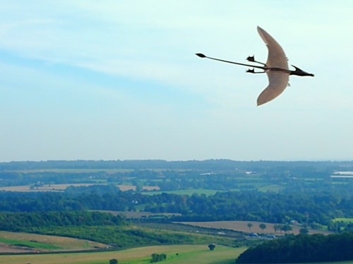
A strange creature over Thurnham
How do you get there then?
Head away from London on the M2. At junction 5 turn southwards down the A249. After about four miles watch for a sign saying White Horse Wood Country Park (on your left - if you reach the M20 you’ve gone two miles too far, darn it!) Drive in and pay £1.20 to park. Walk straight ahead for about three hundred yards through a couple of gates to the slope. If you’re unsure which way to walk, scan the horizon for gliders.
__________________________________________________________
Thurnham Castle Hill overlooks the village of Thurnham in Kent. The slope is sometimes referred to as Detling by slope soarers.
Sometimes the lift is not as good as at higher hills, but it seems to be plenty for efficient moulded soarers (paulw photo)
Thurnham Castle Hill is a very kind slope with plenty of room for stress-free landings. The slope is of medium steepness and is about 70 metres high. It doesn't produce quite as much lift as some of the bigger hills on the South Downs, but nevertheless the lift can be pretty good - which is why Thurnham Castle Hill is such a popular spot for Kent flyers.
Thurnham works well in WSW to SSW winds - and possibly west wind but not really south wind - up to about 20mph. In stronger winds it gets blown out and the lift actually reduces. The very best conditions often occur on sunny evenings with the wind at around 8-16mph and with evening thermals augmenting the lift. In low winds paragliders take off from the lower section of the slope and great care needs to be taken to avoid them.
The landing zone is excellent: large and flat, free of turbulence, and covered in nice soft grass. In fact it must be one of the nicest landing areas anywhere. The hill is public access land owned by the local council. Behind the landing area is a country park (where the carpark is) with a sign advising visitors "It is great fun to watch the model aeroplanes while enjoying a picnic"!
Just to the west of the main Thurnham slope can be seen a knoll that faces southwest around to southeast. Behind that is a southwest facing bowl. Both of these are as good as the main slope, yet they are seldom used, perhaps for no other reason than they involve walking several hundred yards further.
Thurnham might be the only slope with its own weather report: believe it or not, a local pharmacy puts a live wind meter online here: Thurnham Weather.
There are two other worthwhile slopes a few miles west of Thurnham Castle Hill - Holly Hill (which works in south to southeast winds) and Blue Bell Hill (which works in south to southwest winds) - see the Holly Hill section for details of these.
Foam flying wings can take the knocks and are popular with father and son flying teams
Thurnham Castle Hill scores 6 in terms of quality of lift. However, sociable flyers would rate Thurnham higher due to its friendly atmosphere - Thurnham hosts the largest and friendliest bunch of slope soarers in Kent. On the other hand, flyers who seek solitude might prefer nearby Blue Bell Hill or Holly Hill.
A strange creature over Thurnham
Head away from London on the M2. At junction 5 turn southwards down the A249. After about four miles watch for a sign saying White Horse Wood Country Park (on your left - if you reach the M20 you’ve gone two miles too far, darn it!) Drive in and pay £1.20 to park. Walk straight ahead for about three hundred yards through a couple of gates to the slope. If you’re unsure which way to walk, scan the horizon for gliders.
WATERSHIP DOWN, HAMPSHIRE - Winds: N, W
Where’s that then?
South of Newbury, west of Basingstoke: 40 miles west of the M25.
So what’s it like?
Watership Down has two separate hills, Ladle Hill to the west and White Hill to the east. They are about two miles apart. A bridleway with some flyable spots runs along a ridge between them. A third spot, Beacon Hill, is a mile further west, outside Watership Down.
All season soaring
White Hill is the best spot and also the easiest to access. On the west side of the road are two bowls that face northeast. Flyers use the second bowl. The area is not as high as the slopes on the South Downs but there is clear countryside for miles in front so the lift is good. Landing opportunities are reasonable. There is a fence behind the flying area to keep walkers off the racehorse gallops, so try not to land back there. Gliders should not be flown when racehorses are being exercised in the area (although the horse riding often takes place too early in the morning to affect glider flyers).
It is possible to cross country soar all the way along the ridge to Ladle Hill, but access is sometimes difficult. You would need to walk it and plan your route before trying to fly it.
There is also a slope on the east side of the road, accessed from the carpark. The slope faces northwest. It is a wide, fairly shallow slope with reasonable lift. Although you can’t see the road from the slope, you will be flying over it, so you need to take care not to ditch a plane down there. This is also a horse riding area so care needs to be taken. There is a large field behind the slope that must not be used to land in: for one thing, it would involve hoisting your svelte form over a barbed wire fence, and for another, the farmer would not thank you for flattening crops.
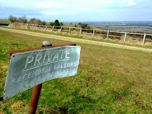
Soaring is not possible when racehorses are being exercised
Ladle Hill, two miles west, has a slope that curves from west through northwest to north. It is not as good as it used to be because trees on the slope are growing taller and creating turbulence.
The majority of Watership Down is privately owned, much of it by Andrew Lloyd Weber. The landowners do not mind considerate slope soarers flying here, but as a visitor you need to be on your best behaviour to ensure you don’t mess it up for local flyers. By agreement with the landowners, planes are not flown when racehorses are being exercised (usually early each morning except Sundays).
Beacon Hill is just over a mile further west from Ladle Hill, on public land on the other side of the A34. It works in a variety of winds with the best being southwest. There is a carpark at the base of Beacon Hill but it’s a hard climb from there to the top. The hill
overlooks Highclere Castle, the setting for the television series Downton Abbey.
Marks out of 10?
Watership Down gets 6.
How do you get there then?
Take the A339 which runs between Basingstoke and Newbury. Halfway between the two, exit at Kingsclere. In the centre of Kingsclere take the B3051 (signposted Overton) for just over a mile to White Hill. You’ll see lay-bys on each side of the road as you approach the crest of the hill. There is also a carpark on the left.
To reach the main flying bowl, walk west (across the road from the carpark) for a hundred yards, past the first bowl, and take the path to the right. Go through the metal gate beside a horse jump. Follow the slope to your left for 100 yards and you will come to the main bowl, which is where flyers have permission to fly from.
White Hill Map
Ladle Hill Map
Beacon Hill Map
_____________________________________________________________________________