![]()
SLOPE SOARING SITES OF SOUTHERN ENGLAND
SLOPES E-J
Here's information on radio control slope soaring sites (model glider flying slopes). This page lists slopes beginning with E to J. Download the pdf from the Home page if you want this information in a prettier format with more photographs.
_____________________________________________________________________
FIRLE BEACON, EAST SUSSEX - Wind: N
Where’s that then?
Near the south coast, off the A27 between Brighton and Eastbourne.
So what’s it like?
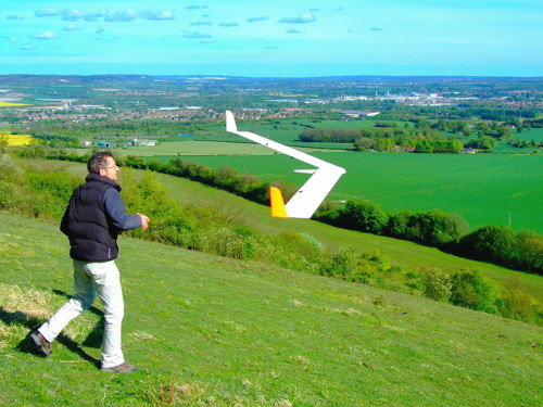
This large, mellow slope has been a popular radio control flying location for over forty years. It is public access land managed by the Firle Estate (apparently the usual National Trust policies apply - unpowered glider flying is welcome but power flying is not). Firle Beacon works best in north wind. The slope seems quite fussy about wind direction: NNW and NNE winds work, but northwest and northeast winds are usually too turbulent (nearby Bopeep Hill is the place to be when the wind is northeast).
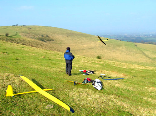
![]()
Firle is popular for a reason
In north wind the lift at Firle is excellent: smooth and reliable. The landing area at the top of the slope is huge, flat and free of obstructions - although you might manage to hit a cowpat if you try really hard. Local flyers describe Firle as a "lovely" slope - which almost sounds a bit damning! Actually it refers to the fact that this is a slope where flyers are likely to enjoy great lift and emerge with their planes intact - and there’s a lot to be said for that.
There are three main slopes: one by the carpark, a second one 800 yards eastwards (to the right), and a third 500 yards to the west (across the road). The second slope offers the best lift of all, but it is less often used because it involves a ten minute walk.
The slope across the road is often used by paragliders when the wind is low, and at these times is best avoided by glider flyers. Should paragliders ever fly into the model flying area, always give them right of way and don't fly too close. (The paragliding association's policy is well worth reading: BHPA Policy.)
A little under a mile west of Firle is a superb but seldom used slope, Beddingham Bowl. It works well in north and NNE winds. The landing area is huge and flat. It is in front of two large telecommunications masts. These can be seen on the horizon from Firle.
A mile further west of Beddingham Bowl is another north facing bowl and a west facing slope - these are described separately in the Itford Hill section, but in fact you can easily hike between them all.
![]()
The bowl on the west side of the road is equally good, although in low winds it is best left to paragliders
Marks out of 10?
Firle is a marvellous slope and earns 8.
How do you get there then?
From London go down the M23 to the A27 and get yourself going east on the A27. The turning is on the right half a mile past Beddingham. It is signposted Firle and also has a larger green sign advertising the stately home Firle Place. Once you've made the turn, go straight for two miles, through Firle village, up the road with the 'No Exit' sign to the slope. Park in the carpark on the left at the crest. The gate to the landing area is near the far end of the carpark. Walk eastwards for ten minutes to reach the best flying spot.
Beddingham Bowl is accessed by hiking west along the South Downs Way from Firle. It only takes about 15 minutes. There used to be a road that led up to Beddingham Bowl from the A27, but this has now been closed to motorised traffic. You can still cycle up if you are feeling particularly keen.
Firle Beacon Map
Beddingham Bowl Map
____________________________________________________________________________
HOLLY HILL, KENT - Wind: SE
Where’s that then?
Off the M20 in Kent, around 10 miles from the M25.
So what’s it like?
In the 1980s Holly Hill was the place to fly in Kent. However it became overgrown with brambles and is now seldom used. But here's the rub: recently the Council has been clearing the bushes as part of a new policy of returning downland to its original grassy state, and once again Holly Hill is quite a good place to fly. Flyers are only just rediscovering it, so it's a bit of a hidden gem.
Holly Hill faces SSE and works well in south to southeast winds. It is higher than the current most popular site in Kent, Thurnham Castle Hill, and often produces a little more lift than that hill.
The landing area is not bad ... but not exactly great either. The landing area is basically the slope itself. You have to land uphill - by coming in really low and rising up the slope below the wind - or by landing sideways along the top of the slope. This can be a little tricky to achieve, so Holly Hill is definitely not the place to fly large fragile models.
The upper part of the slope is public access land (the Pilgrims Way, managed by the local council), but the lower part is private farmland. So it is best to stay on the upper portion of the slope.
A weather station has been set up near Holly Hill and you can see an online live wind report here: Holly Wind
Great lift in south to southeast winds
A few miles from Holly Hill is another slope that merits a mention: Blue Bell Hill. The slope faces south - more SSW to be precise. The lift can be good but is seldom smooth. Scrub is encroaching onto the landing area, which is now not much bigger than your average kitchen table. This, combined with the fact that the slope often has picnickers on it, means that Blue Bell Hill is not really suitable for beginners. Access to the slope is easy since the carpark is right at the top of the slope. There is also another similar slope a hundred yards to the right of the main slope.
Marks out of 10?
Holly Hill has got to be worth 5 despite the fact that it is seldom used.
How do you get there then?
Holly Hill is a couple of miles north of the M20. Exit at Junction 4 (the A228) and drive into the village of Snodland (if you think this is a rather odd name, consider that the estate on the hill is called Punish and Snodland had a bishop named Gandalph!) In Snodland turn left at the High Street and continue straight onto Constitution Hill until the end of the road (it changes name a couple of times but you can see the slope straight ahead in the distance). At the end of the road turn right and drive up the hill. Park on the side of the road at the junction where Birling Hill becomes White Horse Road. There is a North Downs Walk sign marking the entrance to a path. The slope is through here, to your left.
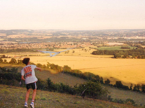
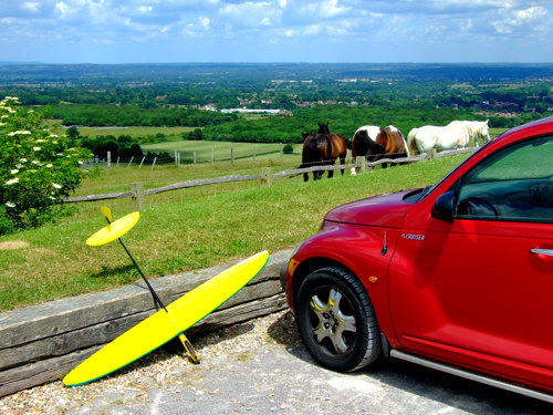
Holly Hill twenty years ago (check out the similarity with the photo above - it's even the same guy!)
To get to Blue Bell Hill, go back onto the M20 for two junctions east, then head north up the A229 for a couple of miles. Exit left when you see the Blue Bell Hill sign. This slip road curves back on itself and takes you straight into the carpark (named Blue Bell Hill Picnic Site). If you don’t like the look of Blue Bell Hill, Thurnham Castle Hill is only a couple of miles east of here (see the separate listing for Thurnham Castle Hill).
Holly Hill Map
Blue Bell Hill Map
____________________________________________________________________
ITFORD HILL, EAST SUSSEX - Winds: W, N
Where's that then?
Overlooking the A26, which is the road that goes from the A27 down into Newhaven.
So what's it like?
Itford Hill has got to be one of the best slopes that seldom gets used for slope soaring. Perhaps this is because the parking is at the bottom of the slope and it’s a 10 minute hike up the hill - let’s face it, people would really prefer a nice carpark at the top with a model shop and a Starbucks. The slope that is visible from the road is a large, bare, west facing slope. To be precise it faces WNW. It produces good lift despite the fact that the slope has a slightly shallow gradient. There is a nice large flat landing area. Itford Hill is one of the few slopes where it is feasible to start flying at the top and walk all the way down the hill back to your car while flying.
West slopes are uncommon but this is one of them
Behind the landing zone hides a remarkable surprise: a fantastic north-facing bowl. The only reason Itford Bowl doesn’t get used is that it is not visible from the road and it takes 15 minutes to walk to it. (In 1922 a remarkable world gliding record was achieved at this spot and the story is here: Itford Hill Competition.)
If you walk a few hundred yards south from this bowl, you come to yet another option: a shallow south-facing slope. This south slope is flyable but it is only minor compared to the excellent north bowl.
Marks out of 10?
Itford Hill and Itford Bowl are worth 6.
How do you get there then?
From the A27 turn south at the A26 roundabout towards Newhaven. After two miles park in the layby on your left, just before a large footbridge (which is the only bridge over the A26). Walk eastwards up the meandering South Downs Way to the top of the hill - it’s an easy 10 minute walk. About two miles further along the South Downs Way is the major slope soaring site of Firle Beacon.
_______________________________________________________________
IVINGHOE BEACON, BUCKINGHAMSHIRE - Winds: W, N, NE, S
Where’s that then?
To the northwest of London, up the A41, 20 miles outside the M25.
So what’s it like?
Ivinghoe is one of the premier soaring destinations near London. It features a variety of slopes. Each slope is good, although not all of them are great. What is great is that Ivinghoe has slopes facing almost every direction and so can be flown in almost every wind. Friendly flyers can be found here on most days and there is an excellent soaring club (see ivinghoe.org.uk). Membership of the club is optional but is highly recommended - many consider it to be one of the best clubs in the country.
![]()
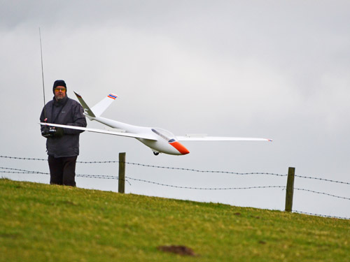
The trick at the steep west slope is to launch and then stop running pretty damn quick (someone ought to tell the dog!)
Ivinghoe has slopes facing west, north, northeast and south. The slopes vary in steepness and so there is something at Ivinghoe for everyone. It works for a remarkable variety of winds: north, northeast, east, southeast, south, west and northwest. So the only wind direction that does not work well at Ivinghoe is southwest.
The best slope is the west one, a very steep slope with very good lift. However - wouldn’t you know it? - this slope is one of the furthest from the carpark. Some flyers complain about this 10 minute hike because it is mildly uphill, but it’s fine if you have an easy-to-carry plane. On the other hand if you’re lugging a 5-metre scale model...
There are two milder slopes near the carpark for north and northeast winds: carpark slope and triangle slope. The lift on these isn’t huge but they are good for relaxed thermalling.
![]()
Ivinghoe has the camaraderie lacking at less popular locations
Marks out of 10?
Each slope individually scores in the 5 to 7 range. However, mix them together and add a healthy dash of friendly club atmosphere, and Ivinghoe has got to be an 8.
How do you get there then?
Ivinghoe is near Dunstable. From the M25 go up the A41 for 15 miles and exit at Tring. Follow the signs to Ivinghoe for 4 miles. At Ivinghoe village turn right at the brown Ivinghoe Beacon sign and after one mile you’ll see Ivinghoe Beacon on your right. Drive half a mile up the access road and park in the carpark. Two slopes are right in front of you and the others are on the ridge on the far side of the fields.
Ivinghoe Beacon is National Trust land. BMFA insurance is required and the frequency control pegboard operated by the club must be used. Your best bet is to check the club's website for visitor requirements before you go, and make contact with club members when you arrive - they won't bite, honest! Electric powered soarers are not allowed, but you can always just tape the blades to the fuselage.
By the way, nearby Dunstable Downs is also occasionally recommended as a slope soaring site, but in fact model flying is banned there. Ivinghoe is for the slope soarers, Dunstable for the kite flyers and paragliders.
____________________________________________________________________________
JACK AND JILL HILL, WEST SUSSEX - Wind: N, NE, E, NW
Where’s that then?
Jack and Jill Hill, and neighbouring Wolstonbury Hill, are a handful of miles north of Brighton, just off the main London to Brighton road (the M23/A23).
So what’s it like?
Jack and Jill Hill has two old windmills on it named - you guessed it - Jack and Jill. The wide, gentle slope faces north. It is about 120 metres high; a good big slope. There are no obstructions or trees, and landing is easy - you could land 100 yards from where you intended to land and still not hit anything (except perhaps sheep turds ...)
Jack and Jill Hill is a pleasant slope with easy access and easy landing
The lift is good but not really 'mega' - the slope is too gentle and there is no lip and no funnelling effect - but that means there’s no turbulence and landing is stress-free. So this is a great slope for scale gliders or relaxed circling hunting for thermals. There may not always be enough lift to thrill aerobatics nuts. The best lift is in north to NNE winds. Northeast just about works, but northwest does not.
If you find that Jack and Jill Hill is not delivering enough excitement for your taste, you could consider getting your good self over to Ditchling Beacon, two miles to your right. Alternatively there is a hidden gem of a northeast slope to the left across the road: Wolstonbury Hill.
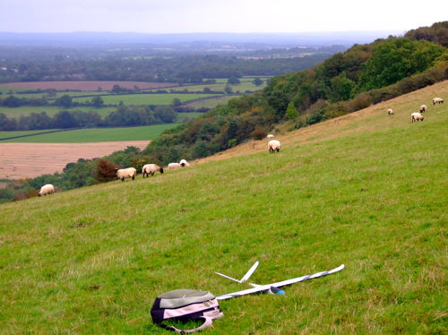
Wolstonbury Hill is just on the other side of the A273 but it is hardly visible from the road. Not many flyers seem to know about it, and it is seldom used. Perhaps the problem is that it involves a five minute hike up the hill. In reality this is not a challenging climb.
The lift is very good in northeast to ENE winds, and usually quite smooth. The landing area is reasonably large and free of hazards. Watch out for full size gliders which sometimes zoom low over the hill.
The far side of the bowl faces east and works well in east winds. It enjoys lift as good as the main northeast section, except that the air can be less smooth because the presence of Jack and Jill Hill across the road adds a dash of turbulence to east winds.
Wolstonbury Hill on a sunny winter day
![]()
Jack and Jill Hill: park and fly
Marks out of 10?
Let's give Jack and Jill Hill 5. It's quite a good slope and deserves to be busier than it actually is. Wolstonbury Hill is worth a similar amount or possibly even 6.
How do you get there then?
From London go down the M23 - avoid the urge to turn into Gatwick Airport, you're not going on holiday but doing something even better! - and exit left onto the A273 about five miles before Brighton. Follow the signs around towards Hassocks on the A273. To get to Jack and Jill Hill, watch out on your right for a little road called Mill Lane which has a small brown sign with a windmill on it. Go up Mill Lane for a couple of hundred yards and park next to the windmills. For satellite navigators the windmills' postcode is BN6 9PG. The slope is right in front of you. If you can be bothered lugging your planes, there are other slopes eastwards (to your right) - including Ditchling Beacon, two miles along the South Downs Way.
Wolstonbury Hill is on the left before Mill Lane, up a small road with signs for a horse riding school. A bridle path leads up the hill (a five minute walk). In the 1970s when Wolstonbury Hill was more often used for slope soaring, flyers used to drive up this bridle path and park near the top of the hill. That is still possible, but the track is very rough, plus it's not clear that motor vehicles really have the right to use it. Both hills are public access land owned by the National Trust.
Jack and Jill Hill Map
Wolstonbury Hill Map
______________________________________________________________________________